
Mankato Block Records Sources
Public sources can help distinguish a Mankato block’s parcels, recorded ownership, civic geography, and historical household leads. They cannot turn an address into a full list of everyone associated with it. The strongest current route begins with adjacent parcels in Beacon, then uses a recorder document when a title question needs proof. MNVotes is designed to confirm one registration with identifying details, not to browse nearby people. The city’s address tool adds neighborhood and district context without disclosing a household.
| Source | Block-level value | Documented access |
|---|---|---|
| Beacon/GIS adjacent parcels | Parcel shapes, PINs, owners, situs addresses, legal descriptions, and map context | County map click-through; fields may be unavailable during maintenance and map lines are not surveys. |
| Recorder deeds and plats | Transfers of ownership and lot, block, or subdivision relationships | Laredo/Tapestry, historical books, or the recording counter; copy charges can apply. |
| MNVotes and voter-file route | Individual registration confirmation or lawfully requested public voter information | Individual lookup or restricted request under Minn. Stat. §201.091. |
| Polk reverse directory | Historical householder leads along an address sequence | BECHS Research Center; 1929–30 reverse section identified, with 1932 reported separately. |
| City address and association tools | Neighborhood area, ward, precinct, services, and representative context | Address input only; no public association roster was located. |
Owner names belong to a parcel record, not a statement about every person who may be connected to the site. A reverse directory is a dated householder lead, while a census is a dated enumerated household. Keep those categories in separate notes. That simple discipline is especially useful on a Mankato block with split parcels, a corner lot, or an old street name.
Map Mankato Neighbor Parcels
Blue Earth County’s map instructions describe the practical Mankato block method: use the search and map tabs, locate the target address, zoom until the parcel shapes and street numbers are readable, then click surrounding properties one at a time. Record the target’s shared boundary, a corner parcel, an alley or street edge, and any parcel that appears split or combined. The county describes click-through to adjacent properties. It does not promise a verified radius or buffer control.
The Blue Earth County map page introduces the search-and-map workflow used for adjoining Mankato parcels.
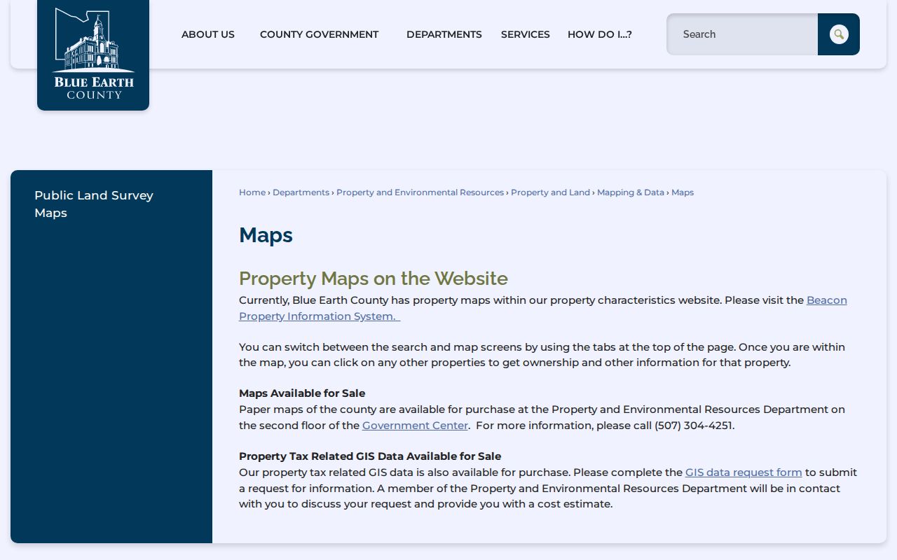
Each click should be treated as one parcel record, not an automatic description of the people around it. Save the map date and copy the PIN, situs address, legal description, and displayed owner into separate fields before comparing the next property.
Why Mankato Block Records Need Maps
Parcel lines help orient a Mankato neighbor search, but the county’s property map carries an explicit warning that its lines derive from plats, surveys, deeds, and contracts and are not surveys themselves. A map may change, and a visible boundary should be checked against a plat or recorded legal description before it is used for a boundary question. The free map is a focused discovery tool, not a substitute for a legal survey or a complete property-data extract.
| Official local source | Commercial neighbor tools | Practical difference |
|---|---|---|
| Beacon parcel record or recorded document | Combined address history and inferred relationships | Official sources identify the parcel or document; compiled profiles can be stale or wrong. |
| MNVotes confirmation or lawful list request | Broad people-search claims | Minnesota limits voter information and does not permit a searchable public voter database. |
| City address and association-area result | “Neighborhood” labels | The city tool identifies civic context, not an association membership list. |
For a Mankato block question, begin with the specific official source that answers it. A parcel map answers where parcels meet. A recorded deed answers a title question. A city result answers civic geography. None creates a complete block roster.
Trace Mankato Neighbor Records
A parcel is a defined piece of land in the county’s system. The Mankato block process should move from an address to a PIN and legal description, then outward to adjoining parcels. It is different from tracing an entire named street. An owner entry can lead to a recorded instrument, but ownership is not the same as current presence at the site. Mark every result with its source and date so a later parcel change or correction can be recognized.
- Locate the known address in Beacon and note the target parcel’s PIN, situs address, and legal description.
- Switch to map view, zoom to the immediate segment, and click each adjoining parcel separately.
- For a title question, use the legal description or PIN with the recorder’s Laredo/Tapestry route, then confirm the recording date and document number.
- For a block’s civic context, enter the same address in the city lookup and retain the neighborhood, ward, and precinct result date.
The Mankato by-street directory is the appropriate next route when the question grows from one block to the full chain of a named street. It uses address-keyed records without flattening the differences between parcel owners and other address evidence.
Mankato Voter Lookup Limits
MNVotes is not a nearby-address browse. The official form requires first name, last name, full date of birth, and either a ZIP or a county, city or township, house-number, and street route. A successful result confirms a registration match under those supplied details. It does not return a ZIP or block list. The service says its data is updated nightly, while a new registration can take up to 14 days to process and appears the day after processing.
The separate public voter-list process is controlled by Minn. Stat. §201.091. A registered Minnesota voter requesting a copy must identify themselves and certify an election, political-activity, or law-enforcement use allowed by law. The list cannot be sold, republished as a searchable internet database, or given out for an unrelated use. Ask Blue Earth County Elections about historical poll books or registration registers; no digitized local run was found in the inspected materials.
Protected voters can withhold address information through the statutory safety process. Do not treat an inactive or cancelled status as a complete statement about someone’s past or present connection to a Mankato address.
Mankato Community-Area Lookup
Mankato’s neighborhood association map accepts a street address and identifies a recognized association area. The city’s Every Voice registration taxonomy includes areas such as Downtown, Riverfront Park, Sibley Park, Lincoln Park, Highland Park, University Park, East University, Skyline, The Prairie, Country Club Park, and several north-side areas. These labels help route an address to a community area. They do not show who belongs to that area.
| Community reference | What the city material identifies | Access and limit |
|---|---|---|
| Neighborhood-association map | The recognized association area for a submitted Mankato street address | Address-based city map; no public member roster located. |
| Every Voice area taxonomy | Selectable recognized areas, including park, downtown, campus, university, and north-side labels | Participation taxonomy, not a directory of members or a complete contact list. |
| Recognized association program | Associations are expected to have bylaws, board representation, goals, and at least three meetings yearly | City materials describe liaison, communication tools, and possible mini-grants; individual channels vary. |
No complete public roster or association-contact directory was located for Mankato’s areas. Use an address result and any association’s own stated contact channel, and do not infer membership from the neighborhood label alone.
Mankato Civic Address Lookup
The City of Mankato address lookup connects one address to neighborhood, ward, precinct or code, congressional and judicial districts, Minnesota Senate and House districts, polling location, council-member information, police-officer information, and service details. These results can change, so record the lookup date. They provide useful civic context around a block without identifying the people who live there.
The Mankato address lookup result shows the civic fields available from a submitted street address.
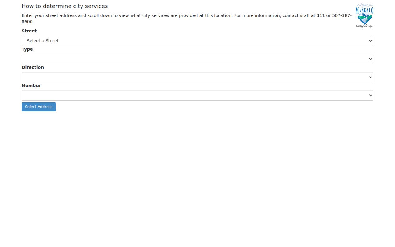
Use these city assignments with the parcel map, not in place of it. A ward or neighborhood can cross different property histories, and city service information does not establish a household’s composition.
Mankato Past-Block Records
Historical Mankato block research needs a different source set. The Blue Earth County Historical Society’s Polk city directories cover 1892–2014, and the collection describes a householder or reverse section by street address beginning with the 1929–30 volume. A separate BECHS newsletter refers to 1932 as the first reverse-directory date, so retain both catalog claims rather than collapsing them. A reverse entry offers a dated householder lead, not proof of every person at the address.
The BECHS finding aids add school yearbooks, church materials, organization records, family papers, and scrapbooks. Indian Lake Sunshine Club membership lists run 1926–97, while AAUW Mankato records run 1918–2003 and include membership rosters. These are historical affiliation records with collection-specific access, not present-day neighborhood rosters. The library’s in-library Mankato Free Press microfilm can also provide dated social notes, announcements, and public notices.
Mankato Block Privacy Limits
A block’s public address chain stops well before it identifies everyone connected with each home. Parcel sources concern land and ownership. Postal and delivery information, motor-vehicle records, and protected-address information are not ordinary public neighbor sources. The Minnesota Safe at Home program gives a participant a designated St. Paul mailing address while protecting the actual Minnesota residence. An unexpected mismatch may be a protection, not evidence that a person is absent or misidentified.
Chapter 13 uses data classifications, so a government entity provides existing public data while withholding information that is private, nonpublic, or confidential. The county Data Practices Policy identifies a responsible authority and compliance official for questions about classifications or accuracy challenges. Recorded documents can also contain personal identifiers subject to redaction rules. Ask the relevant custodian about a record’s release status rather than assuming every field on a document or map is available.
Lawful use. Mankato block research may support personal history, civic context, or a property question. Do not use an address trail to monitor, threaten, contact, harass, or intimidate anyone; Minn. Stat. §609.749 addresses harassment and stalking-related conduct.